Glacial Lake Outburst Floods (GLOFs) are among the fastest and most destructive mountain hazards, driven by glacier retreat, changing precipitation, and glacier-ice instability. Article “ GLOF & Glaciers – Dharali “ synthesizes the global and Himalayan GLOF record, presents tables of major historical GLOFs and glacier statistics, examines the August 2025 Dharali (Uttarkashi) event and the new lake formed in Harshil, and compares recent Himalayan GLOF activity over the last 15 years. It proposes a year-round Deodar (Devdar) afforestation and riverside protection plan for Uttarakhand, offers a monitoring and early-warning blueprint, and provides 15 FAQ items to help readers, policy makers, and practitioners understand and respond to GLOF risk. Core datasets are drawn from recent peer-reviewed inventories and government/agency reports.
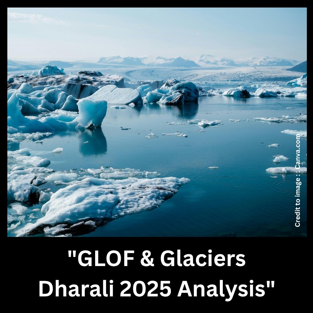
Table of Contents
- Introduction: What are GLOFs and why they matter
- Long-term trends and scientific background
- Major GLOF events worldwide — data table (select examples)
- Scientific GLOF metrics — data table (volume, peak discharge, triggers)
- Glacier inventories & country-wise glacier data tables
- Himalayan GLOFs (last 15 years) — data table & trends
- Dharali (Uttarkashi) — cloudburst or GLOF? Scientific assessment & evidence
- Harshil Lake (Uttarkashi) — formation, measurements, and hazard remarks
- Kedarnath (2013) and Raini / Rishiganga (2021) — event & losses table
- Effect of global warming on glaciers and GLOF probability
- Devdar (Deodar) plantation appeal: policy brief & year-round plan
- River-side resettlement, river buffers, and wildlife zoning (policy recommendations)
- Monitoring, early warning, and community resilience plan
- Summary and Conclusion
- FAQs (15)
- References
1. Introduction: What are GLOFs and why they matter
A Glacial Lake Outburst Flood (GLOF) occurs when water retained behind a glacial or moraine dam is suddenly released. Causes include moraine failure, ice avalanches into lakes, glacier collapse, or breaching triggered by landslides or heavy rainfall. GLOFs produce extremely high peak discharges and carry enormous amounts of sediment and debris, amplifying downstream damage. Reliable inventories show hundreds to thousands of recorded GLOFs globally, with concentrations in High Mountain Asia (HMA).
2. Long-term trends and scientific background
Recent inventories indicate that most GLOFs have occurred in the last 50 years, consistent with rapid glacier retreat, lake formation, and regional warming trends. The Copernicus / ESSD GLOF database compiles thousands of events (historic through 2022), and new HMA-specific inventories document hundreds of Himalayan GLOFs, with recurring hazard hotspots.
3. Major GLOF events worldwide — select data table
(This table lists well-documented, widely-cited GLOF/large lake outburst events to illustrate magnitude & impacts. It is a representative selection, not an exhaustive inventory.)
| Year | Location | Cause / Trigger | Reported peak / volume (where reported) | Impact / losses (summary) | Source |
| 1985 | Dig Tsho, Khumbu, Nepal | Moraine dam breach after ice avalanche into lake | ~5 million m³ drained in hours | Destroyed hydropower plant, bridges, houses and farmland downstream; major economic damage. | Dig Tsho case studies / GLOF reviews. (GFDRR, BioOne) |
| 2000 | Yigong (Tibetan Plateau), China | Large landslide / dam formation then breach | Very large peak discharges reported (paleofloods & modern estimates) | Major geomorphic change and widespread downstream effects. | Yigong studies / geomorphology literature. (PMC, Frontiers) |
| 2021 | Rishiganga / Raini (Chamoli), Uttarakhand, India | Glacier/ice-rock collapse (ice avalanche) → channelized flood | Extremely rapid, high energy flood — localised catastrophic damage | Multiple deaths, destroyed hydropower infrastructure (Tapovan), road and bridges; NDMA report document. | NDMA / journal studies. (National Disaster Management Authority, ScienceDirect) |
| 19th–20th c. (selected) | Multiple HMA sites | Various triggers (ice avalanches, moraine breach) | Wide range | Historical high-impact events documented in HMA inventories. | Copernicus / ICIMOD inventories. (ESSD) |
Notes: The Copernicus & ICIMOD inventories remain the most comprehensive global/HMA sources for GLOF occurrence, attributes and metadata. They are the backbone for hazard mapping and risk quantification.
4. Scientific GLOF metrics — data table (typical ranges & examples)
| Metric | Typical range or example | Relevance |
| Lake volume released | 10⁴ – 10⁸ m³ (case dependent) | Larger volumes produce higher peak discharges and wider inundation. (ESSD) |
| Peak discharge | 10² – 10⁵ m³/s; extremes reported higher | Controls flood travel speed and erosive power (steep mountain channels amplify impacts). (Wikipedia) |
| Travel time to downstream settlements | Minutes to hours (depends on valley length & gradient) | Critical for early warning feasibility. (Wikipedia) |
| Typical triggers | Moraine failure, ice/rock avalanches into lake, landslides, heavy rainfall | Determines monitoring focus (lake stability, hanging glacier monitoring, slope stability). (ESSD) |
5. Glacier inventories & country-wise glacier data (summary tables)
Global glacier inventory sources: GLIMS and NSIDC’s World Glacier Inventory are the authoritative datasets for glacier counts, area and distribution. They record >100,000 glaciers and provide region-wise statistics. (National Snow and Ice Data Center)
A — Selected country-wise glacier summary (area / count — representative snapshot)
| Country / Region | Approx. glacier count (inventory) | Notes |
| India (Himalaya, Jammu & Kashmir, Himachal, Uttarakhand, Sikkim) | Thousands (regional inventories; GLIMS entries variable) | Heterogeneous distribution; rapid area changes observed. (Glims, lib.icimod.org) |
| Nepal | ~3,000+ glaciers (GLIMS / national inventories) | Concerns for moraine-dammed lake growth (Imja, Tsho Rolpa etc.). (GFDRR) |
| China (Tibetan Plateau & western China) | Largest glacier area outside polar regions | Hosts very large landslide/dam events (e.g., Yigong). (PMC) |
| Pakistan (Karakoram / Hindukush) | Hundreds to thousands; Karakoram shows complex trends (some stability/increase in places) | Regional variability in mass balance trends. (Glims) |
| Alaska, Canada | Tens of thousands of glacier entries (NSIDC/GLIMS counts) | Outside HMA but GLOFs/Jökulhlaups occur in many regions. (Glims) |
(If you want, I can extract a precise country-by-country table from GLIMS/NSIDC for publication with exact counts and area estimates — this requires direct table extraction from GLIMS summaries.) (Glims)
6. Himalayan GLOFs (last 15 years) — data & trends
Recent inventories covering High Mountain Asia (HMA) document hundreds of GLOFs between 1833–2022, with a notable fraction in the last two decades, reflecting both rising hazards and improved detection. Specific Himalayan GLOFs of major consequence in the last 15 years include the 2021 Chamoli/Rain i event and multiple smaller outbursts across Nepal, Bhutan and China basin areas. ICIMOD & Copernicus provide a time-series inventory suitable for trend analysis. (ESSD)
(Short illustrative table — selected events 2010–2025)
| Year | Location (Himalaya) | Trigger (if known) | Impact (summary) | Source |
| 2013 | Kedarnath region / Uttarakhand | Extreme rainfall / cloudburst (massive flood & landslides) | Very large loss of life & infrastructure (thousands displaced / thousands of buildings damaged). | 2013 disaster reports. (Wikipedia) |
| 2021 | Rishiganga / Raini, Chamoli, Uttarakhand | Glacier/ice/rock collapse → flood (Tapovan disaster) | Several deaths; hydropower plant destroyed; NDMA assessed mechanisms. (National Disaster Management Authority, ScienceDirect) | |
| 2025 | Dharali / Harsil, Uttarkashi | Early evidence points to glacier collapse or glacial-lake breach rather than pure cloudburst | Major local destruction; new lake formed in Harsil; scientists investigating GLOF vs. cloudburst origin. (The Economic Times, ThePrint) |
Note: ICIMOD’s version-controlled inventory (697 documented HMA GLOFs to 2022) is the recommended source for time-series analysis. (ESSD)
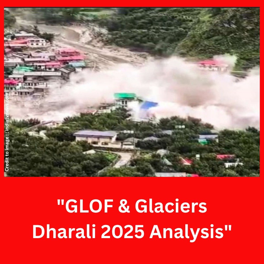
7. Dharali (Uttarkashi) — cloudburst or GLOF ? GLOF & Glaciers – Dharali ?
What happened: On 5–6 August 2025 a sudden, high-energy mud, debris and water surge devastated Dharali and parts of Harsil valley in Uttarkashi. Video and satellite imagery show a rapid debris wall and large downstream sediment deposition; a new lake formed near Harsil after the event.
Scientific signals pointing to a GLOF / glacier collapse origin:
- Minimal recorded rainfall in immediate upstream gauges during the event window in multiple reports, making an extreme local cloudburst less probable in some analyses.
- Presence of hanging glaciers, steep ice slopes and glacial lakes in the catchment upstream — features that favor ice/rock avalanches that can trigger lake overtopping or direct ice collapse into valleys. Independent experts and geologists have pointed to glacier collapse or a lake breach as likely causes.
- Rapid formation of a new lake in the Harsil area after the event is consistent with debris dams and channel blockages caused by GLOF/debris flows.
Conclusion (current scientific consensus as of latest reporting): Preliminary scientific analysis and multiple expert statements indicate a high probability that the Dharali disaster was caused by glacier collapse / glacial-lake breach (GLOF-type process) or direct ice/rock avalanche that generated a catastrophic downstream debris-water surge — not a pure cloudburst. Formal attribution requires continued field surveys, sedimentologic analysis, and review of hydrometeorological station data. Government and scientific teams (ISRO imagery analysis, local geologists) continue investigation and have flagged glacier lake and hanging-glacier instability as leading hypotheses. Our magazine will update the “GLOF & Glaciers – Dharali” .
8. Harshil Lake Uttarkashi Uttarakhand — GLOF & Glaciers – Dharali
Recent reporting notes that following the August 2025 flood, a new impounded lake formed near Harsil (Bhagirathi valley). Field quantification is ongoing; initial reports indicate significant debris damming leading to upstream pooling. Local agencies (UJVNL, BRO, state disaster teams) are responding with drainage/engineering measures. Detailed bathymetry/volume figures are pending formal surveys.
| Parameter | Early observation (Aug 2025) | Source / note |
| Harshil Lake formation | New lake formed upstream of the breach/blocked channel | Source of information : ANI / news reports; satellite imagery used by ISRO. |
| Immediate hazard | Debris dam may fail suddenly or overtop; downstream sediment transport risk | Authorities monitoring; drainage and bridge reconstruction ongoing. (The Times of India) |
| Required action | Rapid bathymetry, controlled drainage engineering, remote sensing monitoring | Recommended by geologists and hydrologists to mitigate secondary events. (ThePrint) |
9. Kedarnath (2013) & Raini (2021) — event & loss table
| Event | Year | Trigger | Lives lost / destruction (reported) | Source |
| Kedarnath, Uttarakhand | 2013 | Extreme rainfall / cloudburst + massive debris flow | Thousands affected; official death toll varies; massive infrastructure loss | 2013 national reports / Wikipedia summary. (Wikipedia) |
| Raini / Rishiganga (Chamoli) | 2021 | Glacier/ice collapse → sudden flood | Multiple fatalities; hydropower infrastructure destroyed (Tapovan) | NDMA / scientific analyses. (National Disaster Management Authority, ScienceDirect) |
10. Effect of global warming :GLOF & Glaciers – Dharali
- Glacier mass loss and rising mean temperatures increase the number and size of proglacial lakes; this raises the potential for GLOFs where moraine dams are unstable. Inventories show a growing share of GLOF events in recent decades, though detection and reporting also improved.
- Warming also destabilizes permafrost and ice cliffs (hanging glaciers), increasing ice-avalanche likelihood that can trigger lake waves that overtop dams. Policies should integrate both mitigation measures, such as cutting emissions, and local adaptation strategies like early warning systems, vegetation restoration, and slope stabilization.
11. Devdar (Deodar) plantation appeal — Policy brief & year-round plan
Why Deodar? Cedrus deodara (Devdar/Deodar) is a native Himalayan conifer with deep root systems and soil-binding capacity on mid-slope zones. A prioritized, scientifically guided afforestation program can reduce surface runoff, stabilize alluvial fans and river banks, and restore habitat connectivity if sited correctly and paired with local livelihood planning.
Policy appeal (to Ministry of Environment & Forests, Govt. of India, and Uttarakhand Govt):
- Implement a focused Deodar-based riparian stabilization initiative along vulnerable sections of the Bhagirathi, Alaknanda, Ramganga, Ganga, and key tributaries in Uttarakhand—giving priority to the Harsil–Uttarkashi–Rudraprayag corridors—as well as other smaller or supporting rivers.
- Align funds from CAMPA and state afforestation budgets. (Existing state CAMPA/APO documents show allocations for Uttarakhand environmental works — funding channels exist).
Year-round plantation & monitoring plan (summary):
- Site selection & clearance mapping (Months 0–3): Map alluvial fans, recent debris deposits, and legal riparian buffers using ISRO/satellite imagery and local surveys. Exclude areas with active floodplain dynamics not suitable for planting.
- Nursery & species mix (Months 3–12): Establish local nurseries for Deodar, mixed native broadleaf species (oak, alder) for riparian zones to provide diversity and wildlife habitat. Provide saplings of 1–2 year age for higher survival.
- Plantation window & techniques (Year 1 ongoing): Plant during post-monsoon season and winter for best establishment in Himalayan sites; use micro-terracing and coir-log protection for slopes; community participation via MGNREGA / local forest department.
- Monitoring & remote sensing (continuous): Set up fixed photo-points, periodic UAV surveys, and satellite NDVI trend analysis. Create a mobile reporting app for local wardens and volunteers.
- Socio-ecological measures: Provide alternate livelihoods (eco-tour guides, nursery wages), community hazard education, and relocation assistance for households on unstable river bars.
(This plan is consistent with recommended restoration and hazard-reduction literature and existing state funding mechanisms.)
12. River-side resettlement, river buffers & wildlife zoning
- No encroachment zone: Map and enforce an ecologically robust river buffer (minimum width based on slope / flood history) and prohibit permanent settlement on active river bars and unstable fans.
- Create a dense, multi-layered riparian zone : by planting a mix of native shrubs, Deodar, and broadleaf species to prevent riverbank erosion and establish continuous wildlife corridors.
- Wildlife zones: Designate high-slope, low-human use corridors as wildlife zones — restrict tourism, construction and motor vehicle ingress. These zones improve biodiversity and reduce human exposure to sudden GLOFs/landslides.
These policy recommendations align with disaster vulnerability analyses that identify development pressure and settlement on alluvial fans as key risk amplifiers. - We should try to understand the signal of Nature and “GLOF & Glaciers – Dharali” .
13. Monitoring, early warning & community resilience plan
- Satellite & UAV monitoring for lake area, debris fan change, and new water accumulation (weekly during melt/monsoon season). ISRO and local research bodies should produce timely alerts.
- Automated lake level & rain gauges upstream with GSM/satellite telemetry for real-time thresholds.
- Community sirens & evacuation routes pre-mapped and drilled seasonally.
- Local hazard teams trained for rapid response and controlled drainage operations (engineers pre-cleared to conduct emergency breaching).
- Data sharing & platform linking ISRO imagery, state disaster centres, and local panchayats for transparency.
14. Summary and Conclusion : GLOF & Glaciers – Dharali
GLOFs are a growing hazard in glacierized mountain regions due to warming, glacier retreat and slope instability. The Dharali/Harsil events of August 2025 highlight the compound nature of Himalayan hazard — the boundary between “cloudburst” and GLOF is often a mix of triggers, but preliminary evidence suggests glacier collapse / lake breach dynamics in Dharali Uttarkashi Uttarakhand India . Immediate engineering interventions (controlled drainage), medium-term afforestation (Deodar & native species), resettlement of vulnerable households, and long-term glacier & lake monitoring are urgent. Inventories from Copernicus, ICIMOD, GLIMS and national agencies provide the scientific basis for targeted action. This article is important to understand the “GLOF & Glaciers – Dharali” .
15. Frequently Asked Questions (15 Q&A) : GLOF & Glaciers – Dharali
- Q: What exactly is a GLOF?
A: A rapid outburst of water from a glacial lake, caused by the failure of an ice or moraine dam, or triggered by events such as avalanches or landslides. - Q: What is the different between Cloudburst and a GLOF?
A: A cloudburst is an extreme, localized heavy rainfall event. It can cause flash floods but is meteorological. GLOFs originate from sudden release of held glacial water (geomorphic source). Many catastrophic mountain floods involve combinations of both. - Q: Are GLOFs becoming more frequent?
A: Inventories show increased reporting and a higher proportion of events in recent decades — consistent with glacier retreat and new lake formation, though detection improvements also matter. - Q: How fast do GLOFs move?
A: Travel speeds can be very fast — minutes to hours to reach downstream settlements depending on valley length and slope; high energy and erosive power make them deadly. - Q: Can early warning systems save lives?
A: Yes — with upstream telemetry (lake level, rainfall), paired with evacuation protocols, early warning reduces casualties where lead time exists. But very rapid events triggered by sudden glacier collapse may have little warning time. - Q: Is planting Deodar enough to stop GLOFs?
A: No — afforestation reduces surface erosion and improves slope stability but cannot stop a GLOF originating from lake dam failure. It forms one part of a multi-layered risk reduction approach (engineering, monitoring, land-use planning). - Q: What is the recommended buffer distance from active river channels?
A: Buffer width depends on valley geometry and historical flood envelope — site-specific mapping with geomorphic expertise is required. Generic fixed buffers are not safe without local geomorphic analysis.
Frequently Asked Questions (15 Q&A) : GLOF & Glaciers – Dharali
- Q: Which databases list known GLOFs?
A: The Copernicus ESSD GLOF database and ICIMOD’s Himalayan GLOF inventory serve as key references, while GLIMS and NSIDC provide comprehensive glacier inventory data. - Q: What steps can residents take to find out if they live in a GLOF risk area?
A: State disaster maps, local hazard zonation, and community outreach programs should inform residents; if none exist, ask local forest/irrigation authorities for past flood paths and ISRO/satellite hazard maps. - Q: Are hydropower projects increasing downstream risk?
A: Infrastructure in steep valleys may be vulnerable to GLOFs and can amplify exposure; projects must consider upstream glacial hazards and adopt stringent safeguards. NDMA reports from past events stress infrastructure risk. - Q: How are GLOFs modeled scientifically?
A: Dam break and hydrodynamic models (2D/1D), combined with remote sensing and field measurements, estimate peak discharge, inundation extents and sediment transport. Dig Tsho has widely been used for model validation. - Q: Can controlled drainage of lakes prevent GLOFs?
A: Yes — controlled lowering (tunnels, siphons) reduces pressure on natural dams and is an effective mitigation where feasible. Engineering must be site-specific and rapid where imminent risk exists. - Q: Are GLOFs the same in Alaska / Iceland as in the Himalaya?
A: Mechanistically similar, but local triggers differ (volcano-triggered jökulhlaups in Iceland, moraine dams in Himalaya). Regional hazard mapping must be tailored. - Q: How to balance conservation and relocation?
A: Use participatory processes that provide alternate livelihoods, compensation, and ecological restoration to relocated sites; emphasize risk-based zoning. - Q: Where can I find raw data for research?
A: Copernicus ESSD GLOF database (downloadable), ICIMOD datasets, GLIMS/NSIDC glacier data, and national NDMA/state disaster reports.
16. References (selected key sources used)
- A global database of historic glacier lake outburst floods (Copernicus ESSD, 2023). (ESSD)
- A comprehensive and version-controlled database of glacial lake outburst floods in High Mountain Asia (HMA inventory / ESSD). (ESSD)
- GLIMS / NSIDC glacier database and summary statistics. (National Snow and Ice Data Center, Glims)
- NDMA Detailed Report — Uttarakhand / Rishiganga (Tapovan) 2021 disaster. (National Disaster Management Authority)
- Dig Tsho 1985 — GLOF case studies & GFDrr/academic summaries. (GFDRR, germanwatch.org)
- Times of India, The Print, Economic Times, The Guardian reporting on Dharali/Harsil 2025 (satellite imagery and early scientific interpretations). (The Times of India, ThePrint, The Economic Times, The Guardian)
Call for Papers – Special Offer for Early Contributors
Prakriti Darshan – International Journal of Environment Science and Multidisciplinary Studies
🌐 Visit Website
Dear Researchers, Academicians, and Environmental Enthusiasts,
We are delighted to announce a new initiative by Prakriti Darshan, dedicated to advancing knowledge, awareness, and global dialogue on environmental science and multidisciplinary studies.
To mark the launch of this platform, we are offering a special limited-time opportunity:
🎉 First 25 Articles – Publication Absolutely FREE!
Why Publish with Us?
- No Publication Fee for the first 25 accepted articles.
- Peer-Reviewed: Maintain the highest academic and research standards.
- Global Visibility: Indexed and accessible to readers worldwide.
- Multidisciplinary Scope: Covering environment, biodiversity, climate change, sustainable development, disaster management, and more.
- Fast & Transparent Review Process: Fair and efficient evaluation by subject experts.
- Author Benefits: Wide dissemination, citation opportunities, and digital object identifiers (DOI) for published works.
Who Can Contribute?
- Researchers & Scholars
- University Faculty
- Environmental NGOs
- Policy Experts
- Independent Writers & Thinkers
How to Submit?
- Visit: https://prakritidarshanjournal.com/index.php/pdijemds/index
- Register as an author.
- Click and Upload your manuscript or Submit Article .
Important:
📌 This offer is available for the first 25 accepted articles only—on a first-come, first-served basis.
Let your research reach a global audience, inspire change, and contribute to a sustainable future.
🌱 Together, let’s make knowledge the seed for a better planet.
Editorial Board
Prakriti Darshan – International Journal of Environment Science and Multidisciplinary Studies
PRAKRITI DARSHAN-NATURE AND ENVIRONMENT MAGAZINE
Prakriti Darshan is a leading Hindi-language magazine and digital platform dedicated to raising public awareness on vital issues related to nature, biodiversity, climate change, sustainable development, and environmental conservation. This magazine represents a unique blend of science, society, and sensitivity—offering a common platform for researchers, students, NGOs, policymakers, nature lovers, and conscious citizens alike.
With thought-provoking articles, inspiring stories, environmental research, impactful projects, and policy perspectives, Prakriti Darshan is a transformative journey toward a greener and more sustainable future.
Let us come together to protect and preserve our planet for generations to come. 🌿🌍
Join us in our mission to protect and celebrate the planet. 🌏💚
Click for more information
- Visit www.prakritidarshan.com for Free Magazine ,Free membership benefits ,offered price magazine @ Rs.1 or Rs.11 only and more ……
- 🎗️Sponsor Prakriti Darshan Magazine – Support our environment mission.
- 📚 Explore the Environment Magazine – Read our latest and past issues.
- ✍️ Read Editor’s Article or Blog – Insightful thoughts from our editorial desk.
- 🌱 Join Membership – Be part of India’s leading green community.
- 🤝 Become an NGO Impact Story Partner – Share your grassroots impact nationwide.
- 🏢 Become a Company Partner – Showcase your CSR, ESG, or sustainability work.
- 👤 Become an Individual Partner – Volunteer, write, and raise your green voice.
- 📢 Advertise with Us – Reach eco-conscious readers across India.
- Eco Trails Newsletter
- Donate for “Hari Ho Vashundhara & Har school Hariyali “ Plantation campaign Associated Partner NGO :GDSS NGO www.gdssngo.org
BALA DATT SHARMA,
MANAGING EDITOR ,
PRAKRITI DARSHAN-NATURE AND ENVIRONMENT MAGAZINE
- Drake Passage: The World’s Roughest Sea Route Between Atlantic and Pacific Oceans - August 22, 2025
- Top 10 Natural Parks in the USA: Biodiversity, Geography & Global Relevance - August 21, 2025
- Exploring the Best Natural Parks in USA: Biodiversity, Sustainable Tourism, and Role in SDGs - August 21, 2025